Modern Borders · Tweedbank
Tweedbank — How a New Community Was Built
Explore how Tweedbank grew from farmland into a planned Borders village, with housing, industry, regeneration, Gun Knowe Loch and the railway.
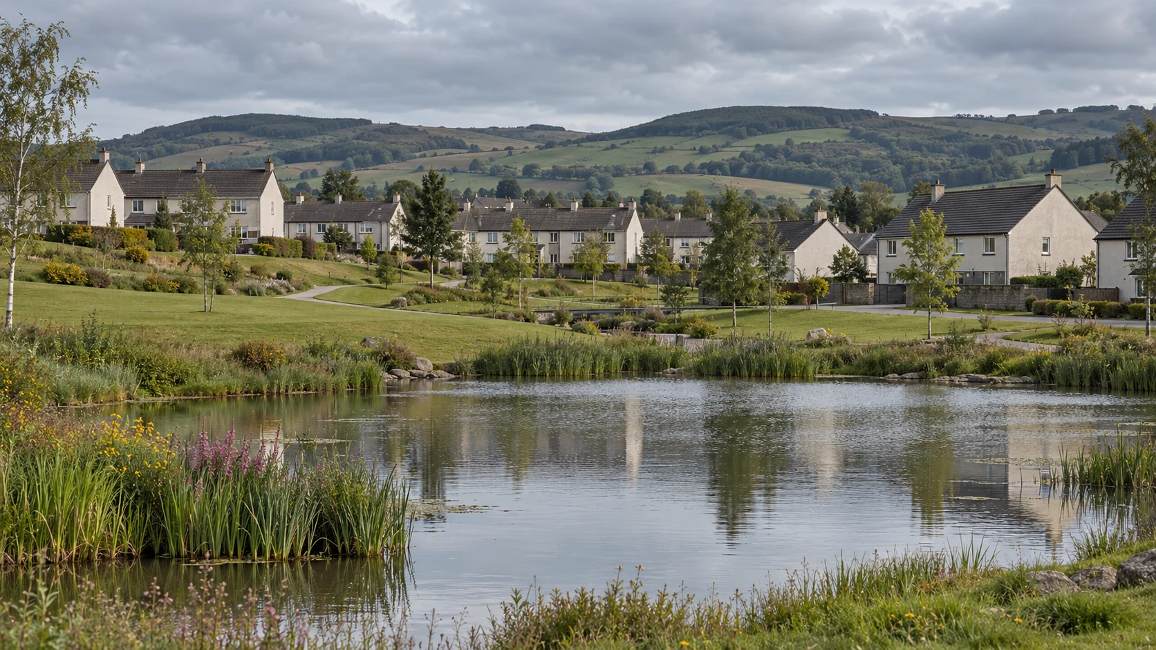
Stand beside Gun Knowe Loch and look towards the houses. Beyond the water are homes, paths and the familiar routines of an ordinary Borders community. Children have grown up here. Neighbours have watched trees become taller than the buildings. Families have stayed, moved away and returned. Yet within living memory, this was a very different landscape.
Tweedbank belongs to the history of the late twentieth century: the years when public bodies tried to plan a new future for the central Borders, housing expanded onto farmland, and industrial employment was changing. Its beginnings were deliberate. The community that followed could not be designed quite so neatly.
This is a story of houses and workplaces, but also of everything needed between them. A village requires somewhere to learn, meet, play and buy the things forgotten on the last shopping trip. It needs routes to the surrounding towns and opportunities to earn a living. Building the first house answers only the first of those questions.
For the people who remember Tweedbank's earliest years, the evidence is often close at hand: a photograph taken from a bedroom window, a school picture, the view before a housing phase was completed. Those ordinary records can tell us how an ambitious plan became somewhere people called home.
Before the Houses
Tweedbank sits between Galashiels and Melrose in a landscape shaped by the River Tweed. The Gala Water joins the larger river nearby, while Abbotsford connects the surrounding country with Walter Scott. These are older relationships than the modern settlement. The land was not an empty space waiting for a planner's pencil.
Before the housing development, farms occupied the area. Fields, working buildings, boundaries and routes gave it a practical geography. The later development changed the purpose of the land, but older names and surviving buildings help us look behind the modern streets.
The community centre's association with the former farm buildings is particularly useful. A new village could incorporate an older structure into a different kind of everyday life. What had served agriculture could become somewhere residents gathered, organised activities and met their neighbours.
Our account of the lost roads before the A7 and A68 explores the wider history of movement across this country. At Tweedbank, comparing an old map with the streets today can reveal a smaller version of that story: which lines survived, which disappeared and which acquired an entirely different purpose.
A New Village for a Changing Borders
In the 1960s, planners were looking at the central Borders as a connected region whose future depended on housing, employment and transport. The 1966 Scottish economic White Paper supplied part of the background. The Central Borders Plan followed in 1968, looking beyond the growth of any single town.
Tweedbank emerged within that approach as a proposed new village. It is useful to distinguish this planned settlement from the formally designated Scottish new towns with their own development corporations. Similar ambitions about modern housing and opportunity did not make every new community the same kind of administrative project.
The attraction of a new settlement is easy to understand. Existing towns have inherited streets, ownership patterns and buildings that can make change complicated. Starting a substantial development on agricultural land appears to offer greater freedom: room for housing, business premises, recreation and a road system designed together.
That freedom is never complete. Land already has owners and uses; infrastructure costs money; households need employment beyond the development boundary. A plan can arrange space, but it cannot guarantee every economic condition on which the proposed community depends.
From a Drawing to a Building Site
Approval and construction were separated by negotiation and delay. The development-plan amendment received approval in 1969, but land acquisition and legal proceedings complicated the start. Work on the distributor road began in March 1973, with the first Scottish Special Housing Association housing construction following that October. Galafoot Bridge opened in 1975.
Those dates describe distinct stages. The idea of a village, permission to develop, a road under construction and an occupied house are not interchangeable beginnings. Different residents may quite reasonably remember a different milestone as the moment Tweedbank started.
Road building mattered because a housing development needs to be connected before it can function as a community. Materials must arrive; residents must reach shops and work; buses and services need usable routes. The road through Tweedbank was therefore part of the village's foundations, even though it is less likely to appear in a family photograph than the first front door.
A good early photograph should be read carefully. A finished row of houses might stand beside unfinished ground. A bare slope might later become a familiar planted space. The image records a stage in the process, rather than a complete account of what the original plan intended.
Houses Arrived in Stages
Tweedbank was not completed in one sweep. Public housing was followed by private development and further housing-association provision. The building programme slowed and resumed under changing political and financial circumstances. Successive phases left a settlement whose appearance records several decades of decisions.
That matters when comparing Tweedbank with an older Borders town. Galashiels expanded over a much longer period around manufacturing and the valley. Tweedbank's growth was more consciously planned, but it still acquired layers. A house built in an early phase and one added later belong to the same community without belonging to the same moment in its history.
Our story of Galashiels' journey from monastic fields to textile mills follows a different route to urban growth. Reading the two together helps explain why neighbouring places can have such different street patterns and relationships with work.
For residents, the distinctions were practical. Which paths were ready? What lay beyond the end of the street? Where could children play? How did a family get to a school or workplace? These are questions for memories and photographs, not details to fill with an invented account of every early household.
A School, a Loch and Places to Meet
The original village-centre proposals included education, gathering places and shops near a central lake. Tweedbank Primary School opened in October 1976. The centre's commercial development took longer, reminding us that facilities shown together on a plan may arrive years apart on the ground.
Gun Knowe Loch is a made landscape feature rather than an ancient natural loch. That does not make it unimportant. A planned feature can become a place around which generations organise their memories: a walk, the birds on the water, a meeting point or the view from a familiar path.
The relationship between water and settlement is different here from that of a mill town. In the industrial valleys, rivers powered machinery and served manufacturing. At the centre of Tweedbank, the loch contributes to the setting and the shared spaces of the residential community.
Recreation belongs in the story alongside housing and employment. Playing fields, paths and sports facilities offer places where people from different streets meet. Their significance is social as well as physical. A building programme becomes a community partly through activities that were never confined to a house.
The Industrial Estate Was Part of the Beginning
The industrial estate must not be added to Tweedbank's history only after the later collapse of electronics employment. Housing and industrial land were connected parts of the original development. A parliamentary question in March 1975 already referred to construction of industrial estates such as Tweedbank.
This distinction changes the story. The estate was not simply built in response to the closures that made headlines in the late 1990s. It belonged to an earlier effort to broaden employment and provide modern premises in the central Borders. Later regeneration inherited an estate that already existed.
An industrial estate offers a different working environment from a traditional mill complex. Separate units, vehicle access and space for different enterprises can accommodate businesses with varied requirements. It also changes what industrial activity looks like from the street: less one enormous employer behind a gate, more a collection of workplaces.
That is an interpretation of the development model, not a claim that every unit succeeded or that every tenant supplied the same kind of job. A proper history of the estate needs individual businesses, dates, employees and records. The buildings establish the setting; the people and firms explain what happened within it.
After the Mill and Electronics Job Losses
The later employment crisis gave that existing industrial landscape renewed importance. The central Borders had seen hopes invested in newer manufacturing alongside textiles. When jobs disappeared, the practical questions remained: where would people work, which businesses could grow, and what premises and skills would they need?
Our account of Bepi, Exacta and Viasystems follows the electronics industry's regional history. When the Mills Fell Silent looks at the contraction of textiles and its consequences for working communities.
Tweedbank's industrial estate belongs beside both stories as part of the search for a broader economic future. It provided a place in which employment could continue and change, but the existence of business land alone could not replace every lost livelihood. A new firm does not automatically require the same skills, pay the same wages or employ the same number of people.
The most revealing accounts will be those of people who moved between sectors. A former mill worker, an electronics employee and someone starting a small business may describe very different experiences of the same regional transition. Their histories can show where regeneration created real opportunities and where adjustment remained difficult.
The Railway Changed the Village's Position
Passenger services on the Borders Railway began on 6 September 2015, followed by the royal opening on 9 September. Tweedbank became the southern terminus of the reinstated section from Edinburgh. A place planned in an age of railway withdrawal now occupied the end of a new rail connection.
The practical change was substantial. Rail access brought another way to reach the central Borders and another connection between local homes, workplaces and Edinburgh. The terminus also concentrated attention on land nearby, including the industrial estate.
It would be misleading to treat the railway as an uncomplicated cure for every difficulty. Transport Scotland's first-year evaluation recorded strong demand alongside capacity and parking issues. A successful connection creates its own questions about access, onward travel and how different groups share its benefits.
Our Waverley Route story follows the longer railway history. Mark's Neidpath Railway Tunnel film offers a different encounter with the region's transport remains. Together they place Tweedbank's station within a landscape where railways have repeatedly altered expectations about the future.
From Industrial Estate to Innovation Park
The railway helped shape plans to renew business space at Tweedbank. Scottish Borders Council's planning guidance explicitly connected restructuring of the industrial estate with the opportunities created by the line. The language changed towards a modern business park, but the underlying question remained familiar: how to support worthwhile employment locally.
The Borders Innovation Park provides a recent chapter. Construction began in July 2020 and the first phase-one building opened in July 2022. In its February 2026 update, the council described phase two as under construction within a three-phase, £29 million project supported by the City Region Deal and partners.
These are dated stages, not a declaration that every proposed element has now been completed. The difference between an announced ambition, a building site, an occupied unit and a measured employment outcome matters just as much today as it did during the first housing programme.
The estate's history therefore runs through several periods: the original provision of industrial land, the changing needs of employers, regional job losses and newer investment around the railway. Treating it as one event would conceal the very process that makes Tweedbank interesting.
How to Make a Proper Then-and-Now Record
An early photograph becomes more useful when its date and viewpoint can be established. Which street is shown? Was the photographer standing in a garden, on a road or beside unfinished ground? Can a surviving building or hill identify the position? A modern photograph from the same safe viewpoint can then show change without guessing what was outside the earlier frame.
Planning drawings need a different kind of care. They record intentions. Some features may have been built later, altered or never realised. The best comparison places the plan beside dated photographs and residents' accounts, allowing each kind of evidence to answer a different question.
We would particularly like to hear about the earliest housing phases, school life, the development of the centre and employment on the industrial estate. Photographs of ordinary working premises can be as valuable as pictures of a major opening ceremony. Record the business name, approximate year and the names of anyone pictured where permission allows.
Do you remember arriving in Tweedbank, or working on its buildings and roads? Did your working life take you from a mill or electronics factory to a business on the estate? Share your memories with Discover Scottish Borders. This new community is now old enough to have a history of its own, and the people who made it are still here to tell it.
Your memories and comments
Do you remember this place, or have something to add? Share a memory, ask a question or help us fill in the story.
Loading comments…